Division Street Transit-Oriented Development (TOD) Pilot

About This Study
This study is about land-use planning and connectivity outside of the Division Street public right-of-way, behind the curb. This work will address zoning, development regulations and east-west connectivity to Division Street. If you are looking for information about Bus Rapid Transit (BRT) work happening within the Division Street public right-of-way, please visit the Spokane Transit Authority’s page about Division Street Bus Rapid Transit.
| Are you interested in learning more about... | |
|---|---|
| Transit-Oriented Development? | Bus Rapid Transit? |
| Land use changes Development regulations and zoning East-west connectivity to Division Street |
Changes within Division Street’s right-of-way Transit station improvements Transit frequency and routing |
| You’re in the right place! | Visit the STA Website |
Project Purpose
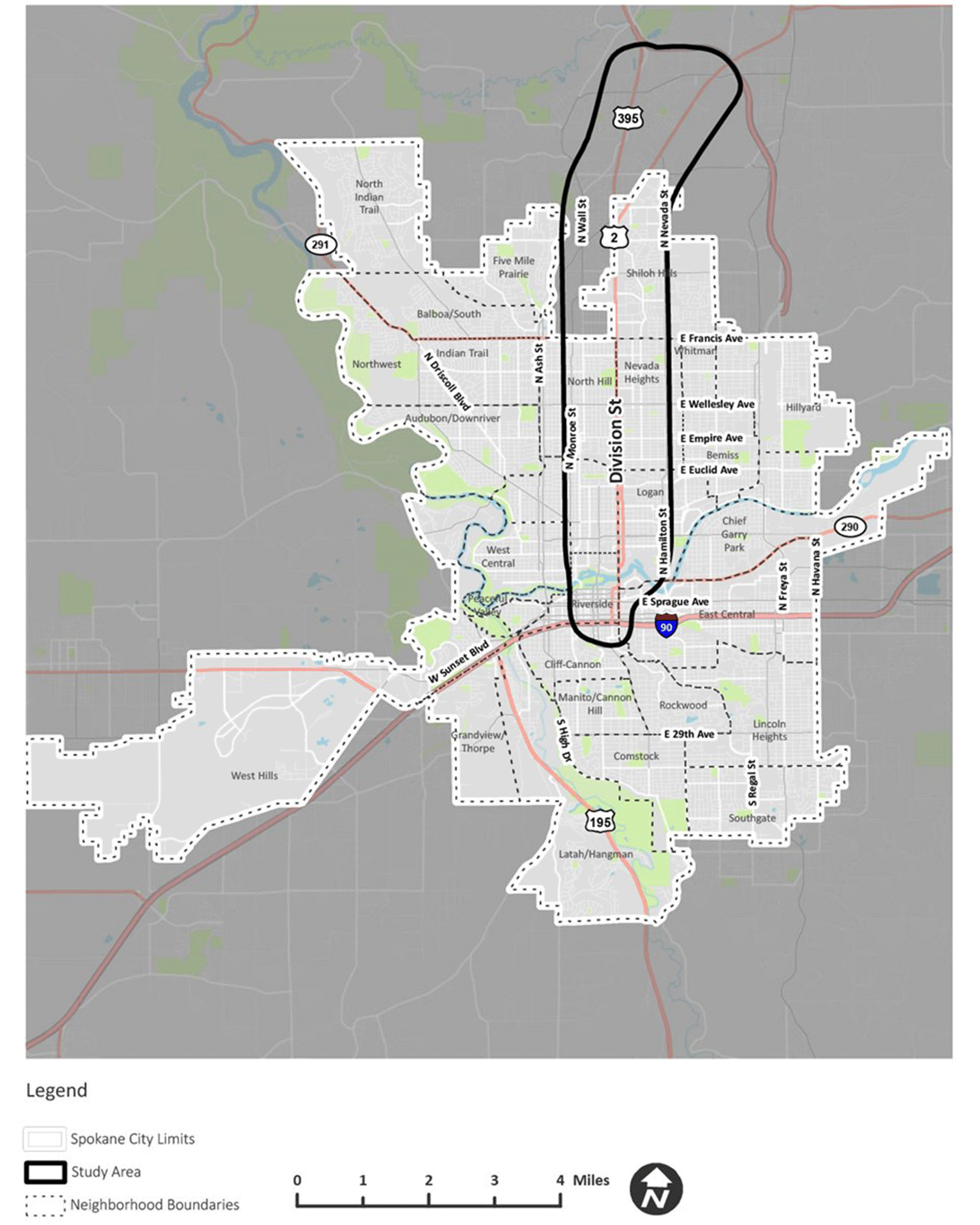
The City of Spokane, Spokane County, and STA will be working with the community to produce a corridor-wide vision for transit-oriented development (TOD) along the Division Street corridor. This vision will be supported by station-specific economic analysis, transit-oriented land-use recommendations, multi-modal infrastructure recommendations, and a development policy framework backed by environmental justice principles. This plan will enable the City, County, and STA to guide future development to achieve transit-supportive conditions around major transit stations.
Funded by $405,000 from the FTA Pilot Program for Transit-Oriented Development Planning, this plan will build upon the integrated transportation and feasibility analysis completed under the DivisionConnects Study conducted by SRTC and STA.
Project Background
Bus Rapid Transit (BRT) on Division Street offers a generational opportunity to update policies and standards that guide land use and development along this major cross-town corridor. In 2030, after the opening of the North Spokane Corridor, traffic patterns will shift and BRT will provide new mobility options on Division Street. This project responds to these transportation investments by developing recommendations for updates to land-use and zoning codes, policies, and design standards that align with these major infrastructure investments.
The Pilot Program for Transit-Oriented Development Planning, offered by the Federal Transit Administration (FTA), supports local jurisdictions in carrying out land-use, zoning, and infrastructure planning that supports these types of high-performance transit investments.
The Spokane Transit Authority (STA), Spokane County, and the City of Spokane applied to participate in the program, proposing to develop detailed transit-oriented development (TOD) plans for selected stations along Division Street. Over the next two years, the FT Pilot Program for Transit-Oriented Development Planning grant, in the amount of $405,000, will support the partner agencies in engaging with the local community to develop plans and policies that make the most of high-frequency transit along Division Street.
Project Scope
The City of Spokane, in partnership with the Spokane Transit Authority as fiscal agent for a Federal Transit Administration TOD Pilot Program grant, and in partnership with Spokane County, is seeking assistance to confirm a community-based vision for transit-oriented development along the Division Street Bus Rapid Transit (BRT) corridor, consistent with the recently completed DivisionConnects study. To carry out this vision, this project will recommend land-use changes, conduct an economic analysis, and recommend connectivity and multi-modal transportation improvements that foster transit-oriented development around select station areas.
A goal of this project is to increase participation and decision-making by racial and ethnic minorities, low-income populations, indigenous and tribal communities, women, renters, and gender-marginalized populations. Therefore, all deliverables should have special consideration for identifying negative impacts on these populations and recommending mitigating efforts.
What is Transit-Oriented Development?
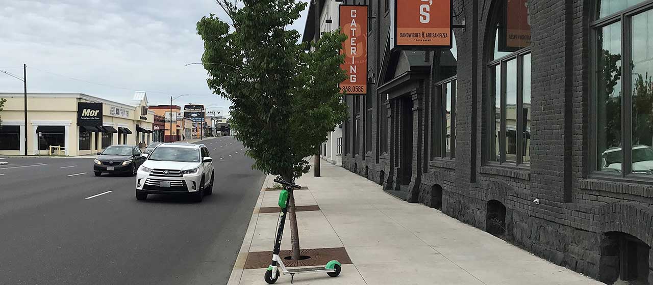
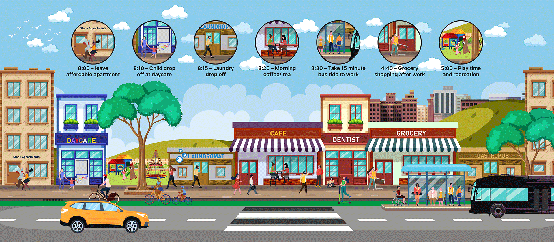
Transit-oriented development, or TOD, offers housing, shopping, and employment along a network of safe streets within a 1/2 mile of high-performance transit lines. Successful TOD offers active street frontages with safe and comfortable sidewalk environments, a mix of goods and services that meet daily needs, and a full range of residential opportunities near transit stations.
For more information, please visit the City’s TOD landing page.
A New Opportunity for Division Street
DivisionConnects, led by the Spokane Regional Transportation Council (SRTC) and the STA, developed a Locally Preferred Alternative for Bus Rapid Transit (BRT) on Division, recommended a program of active transportation improvements, and identified land-use opportunities along the corridor. This Division TOD Pilot Study will build on this assessment by developing station area plans.
BRT on Division Street offers a generational opportunity to support Equitable Transit-Oriented Development, also known as ETOD, to make the most of a major transit investment, support Spokane’s goals for accommodating anticipated growth, and benefit existing residents, businesses, and communities.
The Division Street corridor is the subject of several local and regional plans that recognize the potential for this corridor to provide diverse housing opportunities and more regional and neighborhood commercial uses. The City of Spokane’s Comprehensive Plan identifies portions of Division Street as critical in carrying out the City's “Centers and Corridors” growth strategy for accommodating new residents, housing, and employment. Spokane County likewise supports urban densities for development past the edges of constituent cities.
Division Street, and the planned Bus Rapid Transit route, runs through seven locally defined neighborhoods that have been determined to be at high risk for housing displacement due to socioeconomic status, English proficiency, household composition and disability status, and housing types (as completed in the Housing Displacement Risk Assessment). This regional effort to plan for transit-oriented development will help guide future investment in a way that better supports these historically underserved communities.
Related Information
- Survey for Division Bus Rapid Transit (STA)
- Division Bus Rapid Transit Information (STA)
- DivisionConnects (Spokane Regional Transportation Council)
- The Transit-Oriented Development Pilot Program (Federal Transit Administration)
- City of Spokane Transit Oriented Development
- City of Spokane TOD Framework Study
- South Logan Transit-Oriented Development Project
- Shaping Spokane Housing
- Spokane Housing Action Plan
- Institute for Transportation & Development Policy - What is TOD?
Contact Information
Colin Quinn-Hurst, AICP
Associate Planner
cquinnhurst@spokanecity.org
Tyler Kimbrell, AICP
Planner II
tkimbrell@spokanecity.org
Jackie Churchill
Planner I
jchurchill@spokanecity.org


