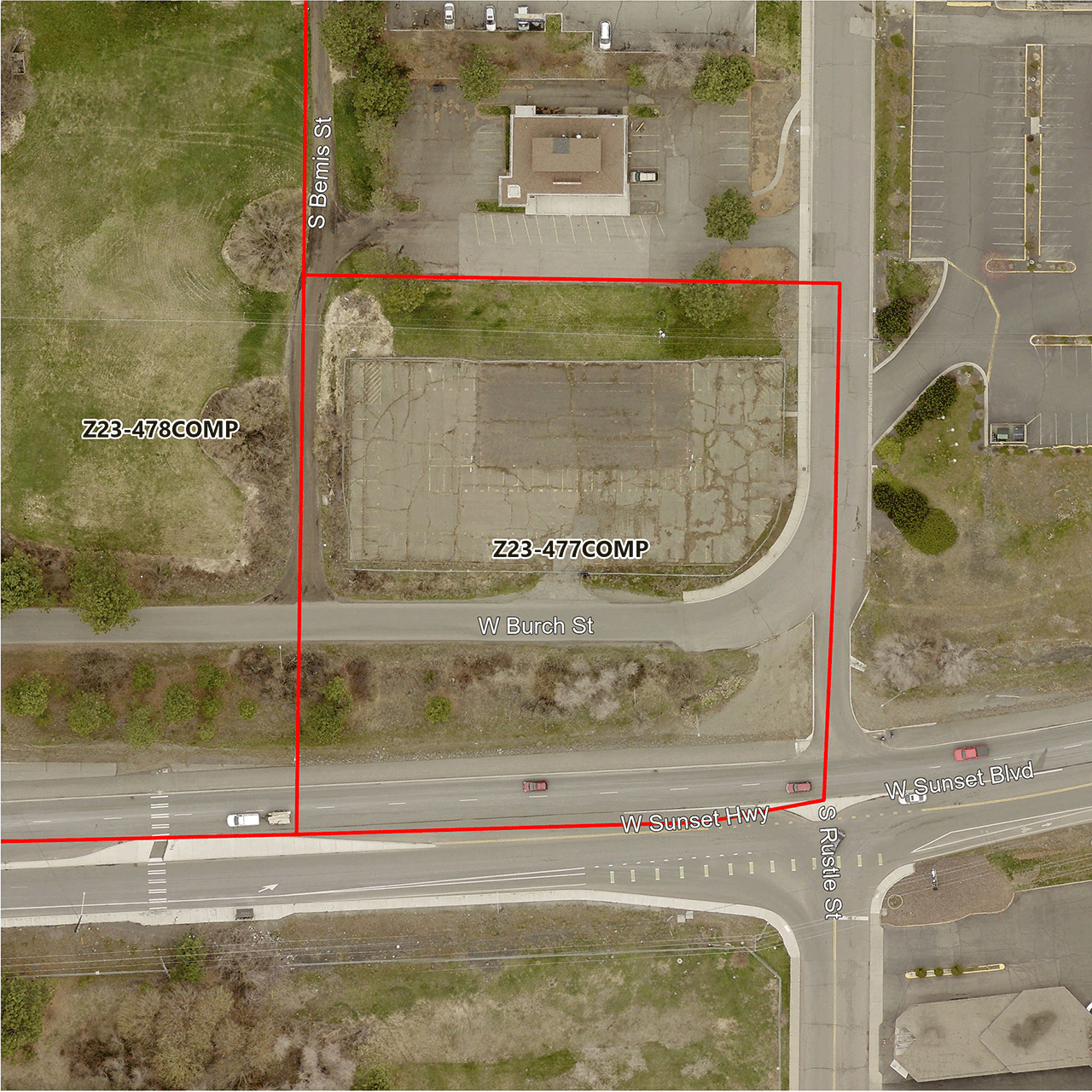
Rustle and Bemis Comprehensive Plan Amendment

Application Number: Z23-477COMP
Address: 1603 S. Bemis St. and 4302 W. Sunset Blvd.
Parcels: 25262.0505 and 25262.0108
Size: 0.84 Acres
Location: W. Burch St. between S. Bemis St. and S. Rustle St.
Neighborhood: West Hills
Proposed Amendments: Land Use Plan Map Designation and Zoning Designation
Land Use Change: “Residential Low” to “General Commercial”
Zoning Change: “R1” to “General Commercial – 70”
See the maps under “Related Documents” for details about the proposed changes.
Applicant
Clifton Trimble, Storhaug Engineering
Description
A proposed amendment to Chapter 3, Map LU-1, Land Use Plan Map and a concurrent amendment to the City of Spokane Official Zoning Map. This project is a private application for a 2023/2024 Comprehensive Plan Land Use Amendment.
Note that this application concerns two parcels located immediately adjacent to a second application, File Z23-478COMP. While the two applications’ cumulative impacts will be considered, these are separate applications with different applicants and agents and should be treated separately.
Related Documents
As the consideration of this proposal progresses, all relevant documents issued by the City will be provided below. Check back in the future as new information and documentation become available.
- Request for Comments (PDF 125 KB)
- SEPA Checklist (PDF 3.3 MB)
- Aerial Photos (PDF 1.1 MB)
- Land Use Maps (PDF 1.2 MB)
- Zoning Maps (PDF 1.3 MB)
- Threshold Application (PDF 2.4 MB)
Contact Information
City of Spokane
Department of Planning & Economic Development
808 W. Spokane Falls Blvd.
Spokane, WA 99201
509.625.6500
Kevin Freibott
Senior Planner
509.625.6184
kfreibott@spokanecity.org
Brandon Whitmarsh
Planner I
509.625.6846
bwhitmarsh@spokanecity.org
