Official Arterial Street Map Update – SMC 12.08.040
What's Happening Now
City staff is updating section 12.08.040 of the Spokane Municipal Code, which is home to the Official Arterial Street Map.
Background
The City completed a revision of TR 12 – Planned Arterial Map during the 2017 Comprehensive Plan update. The purpose of this map is to provide a 20‑year plan for city streets, showing the anticipated long‑term function and location of future arterials.
The City also maintained an Official Arterial Street Map in SMC 12.08.040. While these two maps should match closely, there are a few differences. The Official Arterial Street Map in SMC 12.08.040 is intended to reflect current conditions. It has not been updated since 2008 and has many inconsistencies with the TR 12 Map in the Comprehensive Plan.
| TR 12 Planned Arterial Map located in Comprehensive Plan Chapter 4 |
Official Arterial Street Map located in SMC 12.08.040 |
|---|---|
| 20+ year horizon Anticipated long-term function Show location of future arterials |
Current operations Traffic control decisions Plowing and sweeping priorities Design standards |
| Approving body – City Council | Approving body – City Council |
How will this impact me?
The impact will not be noticeable to most citizens. However some of the changes, if approved, would change local streets into arterials by adding stop signs on the side streets. The streets proposed for discussion on this action are listed below.
During the outreach process staff received many comments about the proposal to upgrade 17th Avenue, Woodside Avenue and Alberta Street. Based on the concerns from the neighborhoods we have removed these three street segments from the proposal.
| Street Segment | Neighborhood | What would change? |
|---|---|---|
| Lyons Avenue from Nevada St. to Crestline St. | Shiloh Hills | Add stop signs on Perry, Helena and Napa where they intersect Lyons Avenue. Remove stop signs on Lyons at Pittsburg. No change to striping. |
| 4th Avenue from Sunset Blvd to Maple St. | Riverside | Replace yield signs on Ash Street at 4th Avenue with stop signs. No change to striping. |
| Main Avenue from Cedar St. to Monroe St. | Peaceful Valley | Change the yield sign to a stop sign at Main / Cedar. |
| 27th Avenue from Southeast Blvd to Ray St. | Lincoln Heights | Add stop signs on Mt. Vernon and Fiske Streets at intersections with 27th Avenue. No change to on‑street parking. A centerline stripe will be added due to the higher volume on this roadway. |
| Cedar Street from Broadway Ave to Summit Pkwy | West Central | Stop signs at College/Cedar would be reversed so that Cedar Street has the right‑of‑way. No change to striping. |
Several other streets that are proposed to be upgraded to arterials already have stop signs and striping. So no changes will be made in the field.
If you have comments or would like to be notified by email of actions related to this proposal, please email inote@spokanecity.org and you will be added to the notification list. You may also contact Inga Note, Senior Traffic Planning Engineer, inote@spokanecity.org or 509.625.6331.
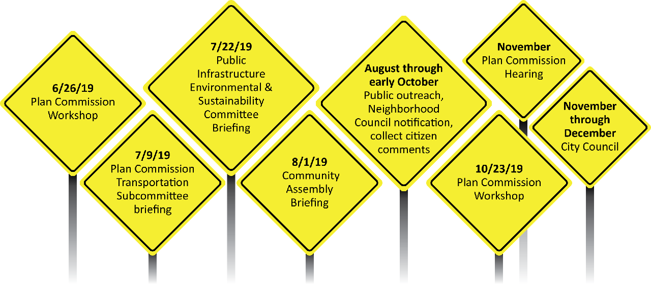
Project Schedule and Opportunities for Comment

- 6/26/19 – Plan Commission Workshop
- 7/9/19 – Plan Commission Transportation Subcommittee briefing
- 7/22/19 – Public Infrastructure Environmental & Sustainability Committee Briefing
- 8/1/19 – Community Assembly Briefing
- Mid‑July through October – Public outreach, Neighborhood Council notification, collect citizen comments
- 10/23/19 – Plan Commission Workshop (no verbal public testimony)
- 11/13/19 – Plan Commission Hearing
- Nov‑Dec – City Council
Informational Links and Documents
- Draft Updated SMC 12.08.040 Map (PDF 1.5 MB)
- Neighborhood Flyer (PDF 2.9 MB)
- 2017 Traffic Volume Flow Map (PDF 1.4 MB)
- Comprehensive Plan (see Chapter 4 for Transportation)
- Existing Official Arterial Street Plan
Contact Information
Inga Note
Senior Traffic Planning Engineer
Integrated Capital Management
808 W. Spokane Falls Blvd.
Spokane, WA 99201-3329
509.625.6331
inote@spokanecity.org
Bob Turner
Senior Traffic Operations Engineer
509.232.8800
bturner@spokanecity.org
