South University District Trail - Feasibility Study
The South University District Trail Feasibility Study assessed the potential for constructing a shared-use path from the south end of the University District Bridge to the Ben Burr Trail. The proposed trail would provide east-west access for safely walking and bicycling through the South University District area.
Background
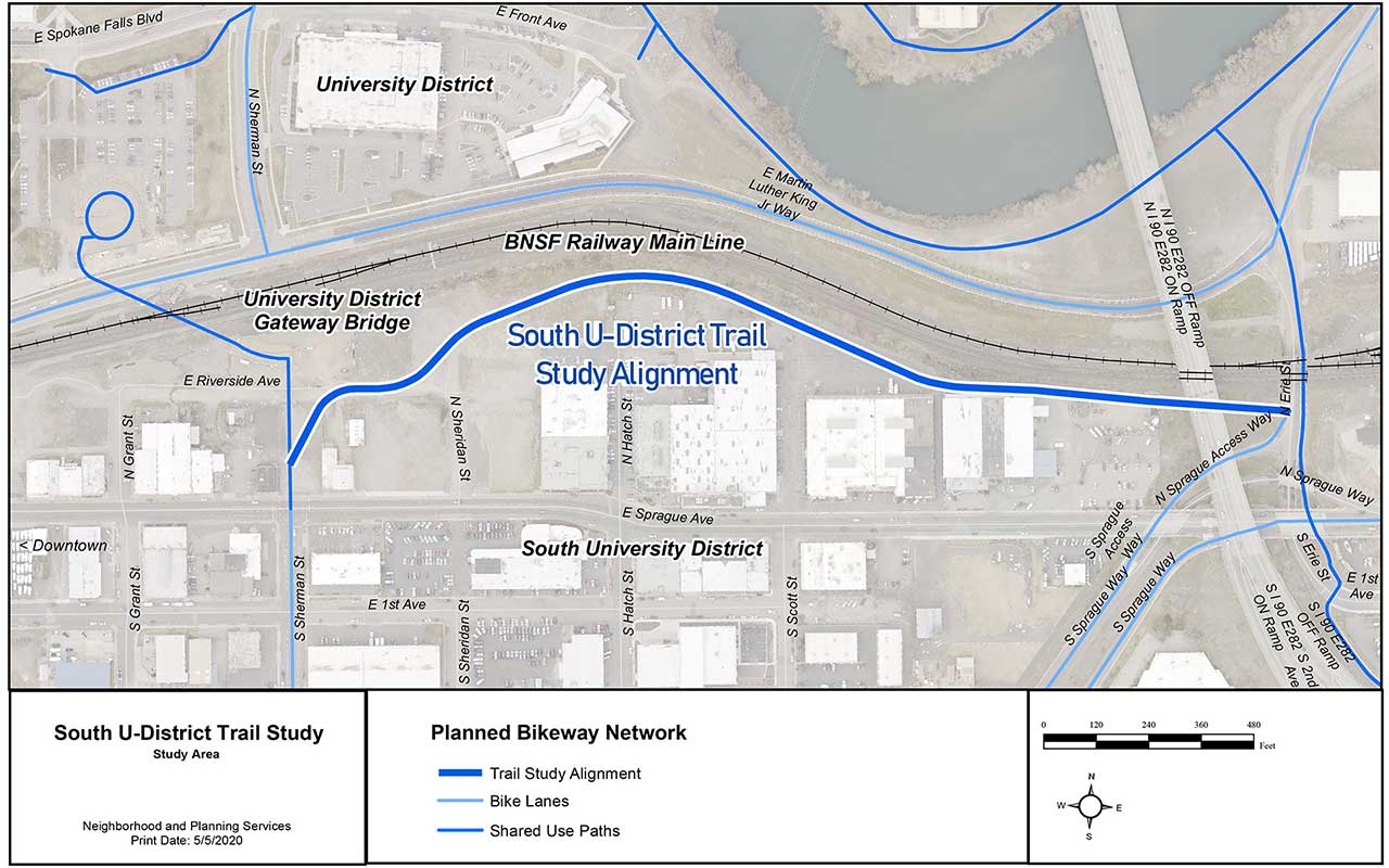
The City's Bicycle Master Plan proposes a pathway connection from the University District Bridge to the Ben Burr Trail, connecting underneath Sprague Avenue, as shown in the map below. This study enlisted the services of Toole Design to assess the feasibility of establishing a public trail along this route. With input from property owners along the proposed trail alignment, which crosses their private property, this study identified an updated alignment and design concept.
Study Area
A map for the 2015 Comprehensive Plan amendment that added this alignment to the Bicycle Master Plan can be found at the link below:
- 2015 Bicycle Master Plan Amendment (PDF 2.3 MB)
Outcomes
After identifying risks and issues that are a factor in placing a trail in this area, this study defined a recommended alignment and preliminary design concepts, addressing:
- A functional alignment accommodating topography and private property needs,
- Needed right-of-way to construct a 12-foot wide shared-use pathway,
- Requirements of trail construction adjacent to BNSF Railway lines
- Constructability, including a geotechnical assessment
- Design up to 30% in order to inform a reasonable cost estimate
Initial Concepts and Next Steps
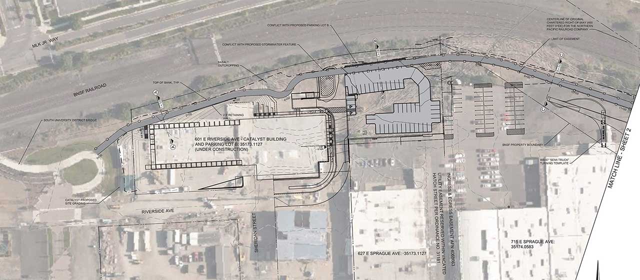
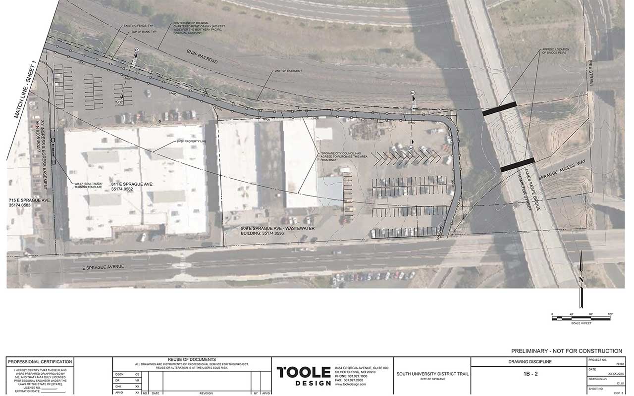
A recommended alignment and design concept has been identified, as shown below. More information is available in the Final Report Document.
Preliminary Design Concepts:
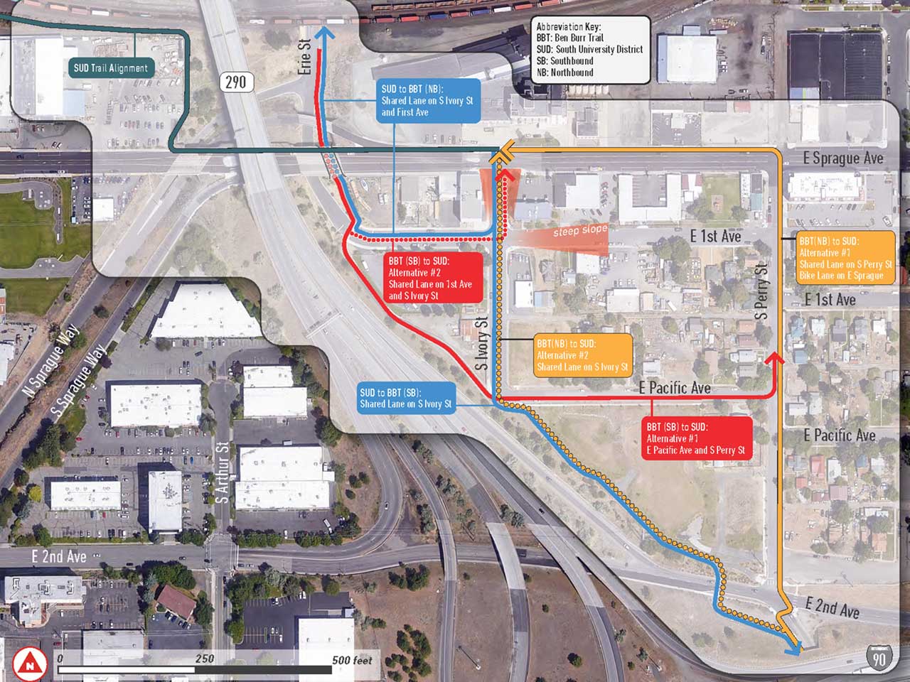
The preliminary concept shown above would connect to the Ben Burr Trail and the Sprague Union Business District with on-street improvements for walking and biking, as shown below.
All concepts shown above are preliminary only. Further development of this concept will depend on additional public feedback, right-of-way discussions with affected property owners, and funding.
Contact Information
For more information, please contact:
Colin Quinn-Hurst
Assistant Planner II
Planning and Neighborhood Services
cquinnhurst@spokanecity.org
509.625.6804


