

Marlene Feist, Director of Strategic Development, Public Works & Utilities, No Phone Number Available
Tuesday, May 17, 2016 at 4:28 p.m.

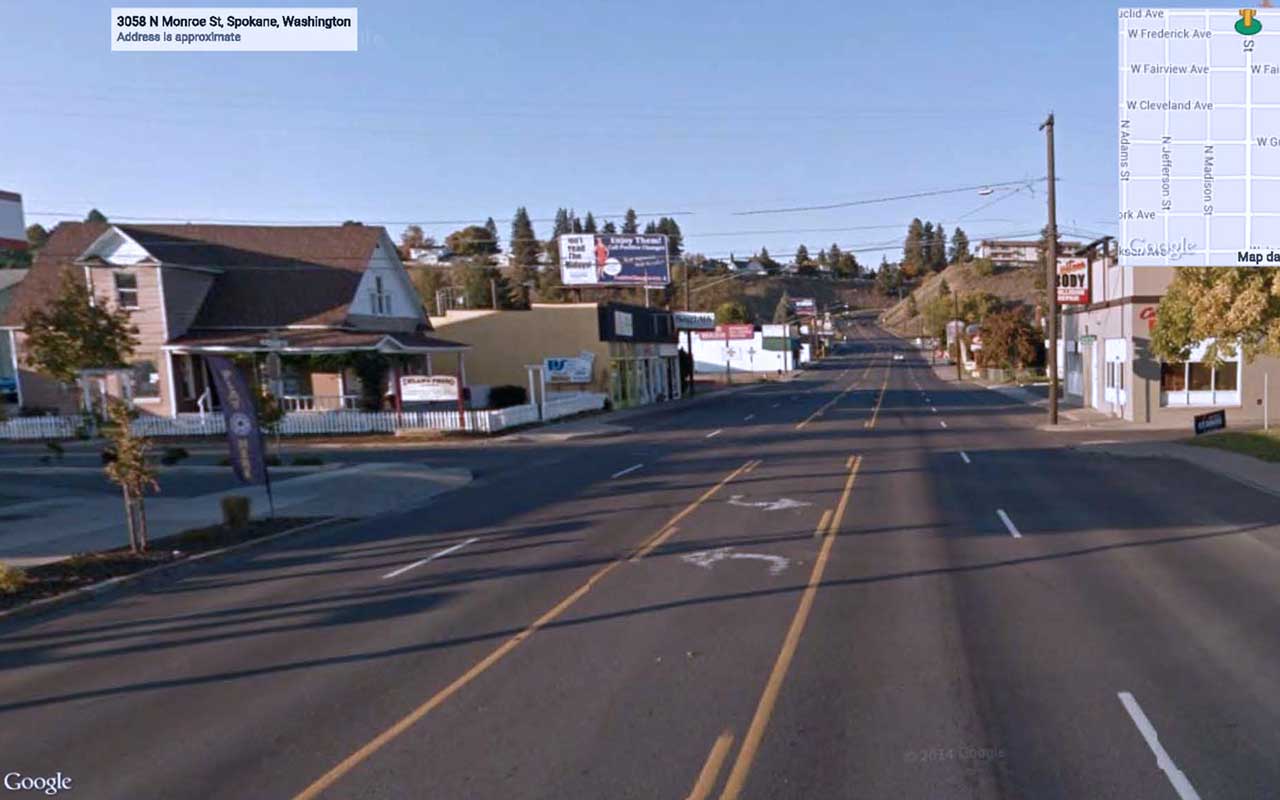
Planning is under way now for that 2018 project, which will improve safety, enhance the streetscape, and reconfigure traffic on North Monroe. The project runs from just north of Indiana to Kiernan near the top of the Monroe Street hill.
Property and business owners, area residents, and representatives from the Emerson-Garfield, North Hill, West Central, and Riverside neighborhoods are encouraged to apply for the advisory board. The group will work with City staff to inform the public and stakeholders about the project and its elements and to help make choices about the final scope of work. Much of the work will be concentrated over the next year.
Applications are being accepted through Wednesday, June 1, following a Council action that created the advisory board on May 16. Send the completed application to the Mayor’s Office by mail at 808 W. Spokane Falls Blvd., Spokane, WA 99201 or by emailing them directly to bcote@spokanecity.org. Members will be appointed by the Council.
At the centerpiece of the project will be safety enhancements aimed at improving the environment for pedestrians and thus enhancing the economic possibilities for the area. Curb bumpouts at intersections that reduce crossing distances, pedestrian refuge islands, pedestrian lighting, and a climbing lane on the hill are included. In addition, part of the corridor will be reconfigured to two travel lanes with a center turn lane, down from four travel lanes with a narrow center turn lane today.
New traffic counts show 16,000 vehicles a day use this section of North Monroe, making it a great candidate for this kind of conversion. A three-lane section, as proposed, is proven for serving up to 24,000 vehicles a day without significantly increasing congestion. Studies have shown that such changes reduce collisions and aggressive speeding, improving safety for pedestrians and motorists.
The City has successfully implemented such changes in other locations, including Sprague Avenue from Grant to Cook streets and 29th Avenue from Cedar to Grand, where the improvements have increased safety and helped improve economic activity for neighboring commercial districts.
The changes can create a better business environment. Customers are more likely to travel the speed limit through a business area and to use the roomier parking stalls. Access from side streets and driveways is improved because motorists only have to cross one travel lane. Pedestrian traffic often increases, as does the use of transit. And in this case, on-street parking can be enhanced to make it more usable. The changes will require an initial adjustment period for motorists.
Revitalizing Monroe Street was identified as a top priority in the Emerson-Garfield Neighborhood Action Plan, which also was adopted by the City Council. Once the project is complete, the street will retain its role as a vital north-south arterial link, but safety will be improved and the business area will be better defined.
At the City, we are working to improve our street and utility infrastructure in an integrated and logical way that balances multiple transportation needs with things like economic development and neighborhood beautification and safety. This project is part of that effort.
For more information on the project, see our updated fact sheet (PDF 2.8 MB).
Current North Monroe Corridor


In Spokane
We All Belong

