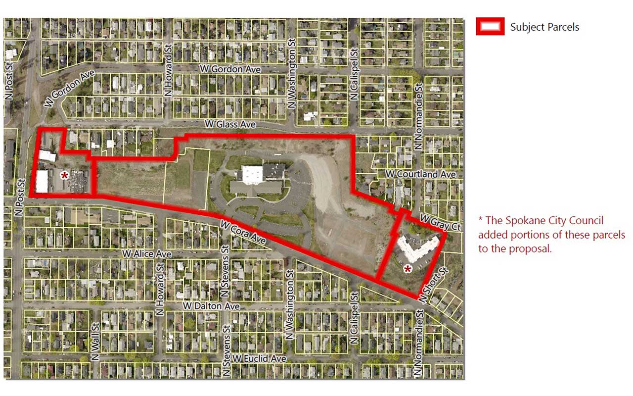
Cora Avenue Comprehensive Plan Amendment

This proposal was adopted by City Council on November 21, 2022.
Application Number: Z21-280COMP
Address:
- 440 & 516 W Cora Ave (private application)
- 3426 N. Post St., 139 W. Gray Ct. (City proposal)
Parcels:
- 35064.3612, 35064.3613 (private application)
- 35063.2005, 35064.3801 (City proposal)
Size:
- 18.87 acres (approximate, private application)
- 0.21 (approximate, City proposal)
Location: North side of W Cora Avenue between N Division St and N Post St
Neighborhoods: North Hill, adjacent to Emerson/Garfield
Proposed Amendments: Land Use Plan Map Designation and Zoning Designation
Land Use Change: "Residential 4-10" to "Residential 15-30"
Zoning Change: "Residential Single Family" to "Residential Multifamily-75"
Applicant
Liam J. Taylor, Storhaug Engineering and City of Spokane
Description
A proposed amendment to Chapter 3, Map LU-1, Land Use Plan Map and a concurrent amendment to the City of Spokane Official Zoning Map. This project is a private application for a 2020/2021 Comprehensive Plan Land Use Amendment.
Related Documents
- Signed Ordinance (PDF 6.1 MB)
- Findings and Conclusions (PDF 219 KB)
- Threshold Application (PDF 2.0 MB)
- Land Use Maps (PDF 2.8 MB)
- Zoning Maps (PDF 2.4 MB)
- SEPA (PDF 502 KB)
- Request for Comments (PDF 3.9 MB)
- Request for Public Comments (PDF 2.3 MB)
- Staff Report (PDF 8.8 MB)
- Determination of Non-Significance (DNS) (PDF 240 KB)
- Hearing/SEPA Notice (PDF 2.3 MB)
- Additional Public Comments (PDF 2.1 MB)
- Applicant Letter Dated October 31, 2022 (PDF 790 KB)
Contact Information
City of Spokane
Department of Planning Services
808 W. Spokane Falls Blvd.
Spokane, WA 99201
509.625.6500
KayCee Downey, AICP
Assistant Planner II
509.625.6194
kdowney@spokanecity.org
Kevin Freibott
Associate Planner
509.625.6184
kfreibott@spokanecity.org
Tirrell Black
Principal Planner
509.625.6185
tblack@spokanecity.org
