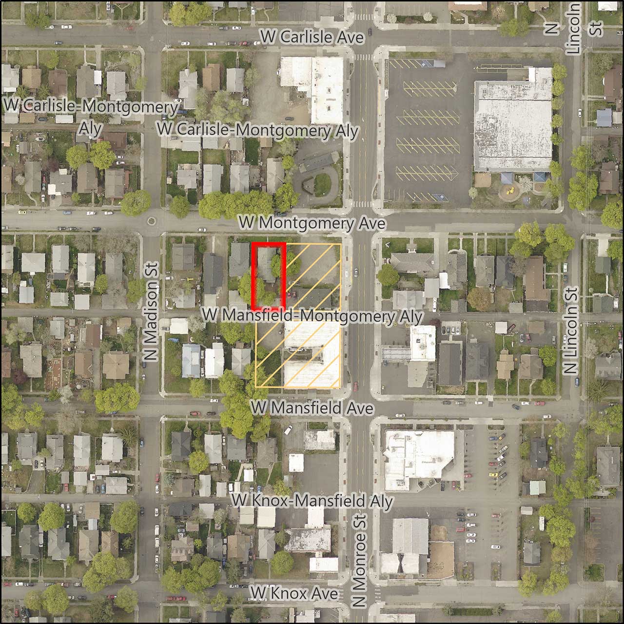
Montgomery Avenue Comprehensive Plan Amendment

Application Number: Z20-207COMP
Address: 1015 W Montgomery Ave
Parcels: 35073.2505
Size: 0.16 acres (approximate)
Location: SW of W Montgomery and N Monroe
Neighborhoods: Emerson Garfield
Proposed Amendments: Land Use Plan Map Designation and Zoning Designation
Land Use Change: "Residential 4-10" to "General Commercial"
Zoning Change: "Residential Single-Family" to "Centers and Corridors Core Type 2"
Applicant
Dwight Hume, Land Use Solutions & Entitlement
Description
A proposed amendment to Chapter 3, Map LU-1, Land Use Plan Map Amendment and a concurrent amendment to the City of Spokane Official Zoning Map. This project is a private application for a 2020/2021 Comprehensive Plan Land Use Amendment.
Related Documents
- Findings and Conclusions (PDF 334 KB)
- Signed Ordinance (PDF 13.9 MB)
- DRAFT Ordinance (PDF 1.6 MB)
- Additional Public Comments (PDF 352 KB)
- Notice of Public Hearing and SEPA Determination (PDF 2.0 MB)
- SEPA DNS (PDF 158 KB)
- Staff Report (PDF 19.8 MB)
- Threshold Application (PDF 1.6 MB)
- Land Use Maps (PDF 2.0 MB)
- Zoning Maps (PDF 1.9 MB)
- SEPA Checklist (PDF 7.9 MB)
- Notice of Application (PDF 1.7 MB)
Contact Information
City of Spokane
Department of Planning Services
808 W Spokane Falls Blvd
Spokane, WA 99201
509.625.6500
Kevin Freibott
Assistant Planner II
509-625-6184
kfreibott@spokanecity.org
